What Has Been Accomplished, What Remains Unknown,
and How Reconnaissance Could Be Conducted More Effectively
Abstract
This white paper examines the first and foundational stage of a multigenerational effort to render Mars habitable for open-air human life: robotic reconnaissance. The central argument is that while nearly six decades of robotic Mars exploration have produced extraordinary scientific returns, the reconnaissance conducted to date has been driven primarily by astrobiology and planetary science objectives rather than by the specific informational requirements of habitability engineering.
Significant knowledge gaps persist in areas critical to terraforming feasibility, including comprehensive global regolith chemistry mapping, subsurface hydrological surveying at scale, long-duration atmospheric monitoring across all latitudes, and detailed characterization of the planet’s remnant magnetic field topology.
This paper catalogs what has been accomplished, identifies what remains unknown, and advances hypotheses regarding how future robotic reconnaissance could be restructured to more effectively serve the requirements of eventual habitation — not merely scientific inquiry. The paper does not assert that terraforming will occur, but argues that if it is ever to be attempted responsibly, the reconnaissance phase must be far more comprehensive and deliberately targeted than current and planned missions provide.
1.1 The Premise
Before a single organism is introduced to the Martian surface, before atmospheric engineering is attempted, before greenhouses are pressurized and humans set foot on regolith, there is a prerequisite that no ambition or technology can bypass: understanding what is already there. Robotic reconnaissance is not a preliminary step to be completed and discarded. It is the permanent informational foundation upon which every subsequent stage of habitability depends. Decisions made in centuries two, five, and ten of a terraforming effort will still be informed by data collected in this first stage.
The principle is simple and uncompromising: you do not modify what you do not understand. The history of ecological intervention on Earth is littered with catastrophic failures that resulted from acting before adequate knowledge was gathered — the introduction of cane toads to Australia, the draining of the Aral Sea, the deforestation of Easter Island. Mars offers no second chances. There is no adjacent ecosystem to compensate for errors. Every action taken on that planet will ripple through an environment with zero biological resilience. The reconnaissance must be exhaustive.
1.2 Scope of This White Paper
This paper is structured in four primary sections. First, a comprehensive review of what robotic reconnaissance has accomplished to date, organized by scientific domain. Second, an identification of specific knowledge gaps that remain unaddressed or insufficiently characterized. Third, a series of hypotheses proposing how reconnaissance could be conducted more effectively if future missions were designed with habitability engineering — not solely planetary science — as a guiding objective. Fourth, a discussion of the implications these findings carry for the subsequent stages of the Mars Habitat Project’s ten-stage framework.
This paper operates within a “could do” framework. It does not predict timelines. It does not assert certainty about technological feasibility. It presents what the available science suggests could be possible if resources, political will, and multigenerational commitment were applied to the problem.
2. What Has Been Accomplished
Humanity’s robotic exploration of Mars spans from 1965 to the present day, encompassing over fifty missions launched by multiple nations, with varying degrees of success. The following review organizes accomplishments by domain rather than chronology, as the relevance to habitability cuts across mission timelines.
2.1 Atmospheric Characterization
The composition of the Martian atmosphere is now well established. Mariner 4’s 1965 flyby first confirmed the dominance of carbon dioxide. The Viking landers (1976) provided the first in-situ atmospheric measurements, establishing surface pressures between 7 and 10 millibars and identifying the seasonal pressure cycle driven by polar CO₂ condensation and sublimation. Subsequent missions — Mars Pathfinder, Phoenix, Curiosity, and Perseverance — have refined these measurements with increasing precision.
The bulk composition is confirmed at approximately 95.3% carbon dioxide, 2.7% nitrogen, 1.6% argon, 0.13% oxygen, and trace amounts of water vapor, carbon monoxide, methane, and noble gases. Average surface pressure is approximately 610 pascals (6.1 millibars), less than 1% of Earth’s sea-level pressure. The atmosphere’s mean molecular weight is 43.3 g/mol, compared to Earth’s 29 g/mol, reflecting CO₂ dominance.
NASA’s MAVEN orbiter (Mars Atmosphere and Volatile Evolution, launched 2013) has provided the most detailed measurements to date of upper atmospheric dynamics and the rate at which solar wind strips atmospheric gases from the planet. MAVEN has confirmed that atmospheric loss to solar wind is ongoing and measurable, directly informing the feasibility assessment for any atmospheric engineering effort. The ExoMars Trace Gas Orbiter (2016) has contributed high-sensitivity measurements of trace species including HCl (up to 4 parts per billion below 30 km altitude) and has placed stringent detection limits on methane at 20 parts per trillion.
Curiosity’s Sample Analysis at Mars (SAM) instrument detected seasonal methane fluctuations in Gale Crater, with concentrations spiking to approximately 7 parts per billion during summer months before declining. The source of this methane remains one of the most significant open questions in Mars science, as potential explanations include geological processes (serpentinization, clathrate release) and, more provocatively, biological activity. The Trace Gas Orbiter has not detected comparable methane concentrations from orbit, creating a discrepancy that remains unresolved.
2.2 Surface Geology and Water History
The geological record of Mars has been systematically mapped from orbit by Mars Global Surveyor (1997–2006), Mars Odyssey (2001–present), Mars Reconnaissance Orbiter (2006–present), and Mars Express (2003–present), and investigated at ground level by five rovers: Sojourner (1997), Spirit (2004–2010), Opportunity (2004–2018), Curiosity (2012–present), and Perseverance (2021–present).
The collective findings establish beyond reasonable doubt that Mars once had abundant surface water. Spirit found evidence of ancient hydrothermal activity. Opportunity discovered hematite, jarosite, and layered sedimentary deposits consistent with long-standing evaporative lakes. Curiosity identified organic molecules, clay minerals, and freshwater environments in Gale Crater capable of supporting microbial life. Perseverance, operating in Jezero Crater — the site of an ancient lake and river delta — has found both igneous and sedimentary rocks with clear evidence of water interaction, including the scientifically significant “Wildcat Ridge” formation and the enigmatic “Cheyava Falls” leopard-spot patterns.
Orbital imaging has documented river channels, eroded valleys, rounded cobblestones consistent with fluvial transport, delta formations, and mineral deposits (including phyllosilicates and sulfates) that require liquid water for formation. The Mars Reconnaissance Orbiter’s HiRISE camera has mapped surface features at resolutions as fine as 25 centimeters per pixel, revealing seasonal flows (recurring slope lineae) that may indicate contemporary briny water activity.
2.3 Subsurface Water Detection
Mars Odyssey’s Gamma Ray Spectrometer was the first instrument to detect significant hydrogen concentrations in the upper meter of Martian regolith, interpreted as water ice deposits. Phoenix (2008) confirmed water ice just centimeters below the surface at 68° North latitude. Orbital radar instruments — SHARAD on Mars Reconnaissance Orbiter and MARSIS on Mars Express — have identified subsurface ice deposits, layered ice structures within polar caps, and potential liquid water bodies beneath the south polar ice cap (the latter remains debated in the scientific community).
Perseverance carries RIMFAX (Radar Imager for Mars’ Subsurface Experiment), the first ground-penetrating radar deployed on a Mars rover, capable of imaging geological structures up to 10 meters below the surface. RIMFAX has revealed subsurface layering consistent with volcanic and sedimentary deposition, providing stratigraphic context for the rocks being sampled.
The volume of water ice confirmed at Mars is substantial. Conservative estimates suggest the south polar ice cap alone contains enough water ice, if melted, to cover the entire planet to a depth of 11 meters. Additional ice deposits exist at the north pole, as mid-latitude glacial deposits beneath dust cover, and as permafrost across much of the higher latitudes.
2.4 In-Situ Resource Utilization (ISRU) Demonstrations
The MOXIE experiment aboard Perseverance (2021–2023) represents the only in-situ resource utilization technology demonstration conducted on the Martian surface. Over 16 operational runs, MOXIE extracted carbon dioxide from the Martian atmosphere and converted it to oxygen via solid oxide electrolysis at temperatures of approximately 800°C. The instrument produced 122 grams of oxygen total, with peak rates of 12 grams per hour at 98% purity, operating successfully across all Martian seasons, during day and night, and under varying atmospheric conditions.
MOXIE’s significance extends beyond its modest oxygen output. It established that ISRU on Mars is technologically feasible, that the Martian atmosphere can be processed by a compact instrument under real operating conditions, and that oxygen of sufficient purity for both life support and rocket propellant oxidizer could be produced from local resources. A full-scale descendant of MOXIE, producing approximately 2 to 3 kilograms of oxygen per hour, could theoretically generate the 25 metric tons of oxygen required for a Mars Ascent Vehicle launch over a period of approximately two years of continuous operation.
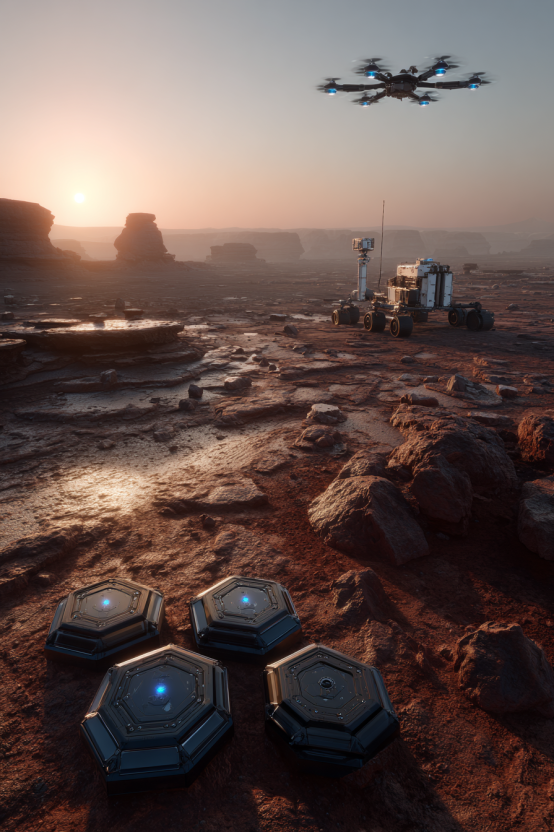
2.5 Aerial Reconnaissance
The Ingenuity Mars Helicopter (2021–2024) demonstrated powered, controlled flight in an atmosphere with less than 1% of Earth’s sea-level density. Designed for five flights, Ingenuity completed 72, covering a cumulative distance exceeding 17 kilometers and reaching altitudes up to 24 meters. Ingenuity served as an aerial scout for Perseverance, identifying geological features, safe driving routes, and potential science targets that would have been invisible from ground level.
Ingenuity’s success fundamentally altered the architecture of future Mars exploration. NASA’s Jet Propulsion Laboratory is currently developing navigation software for future Mars rotorcraft, with a September 2025 test campaign using research drones in the Mojave Desert. Future aerial platforms could survey terrain at scales between orbital imaging and rover-level investigation, filling a critical observational gap.
2.6 Interior Structure
NASA’s InSight lander (2018–2022) was the first mission dedicated to studying the internal structure of Mars. Using a seismometer (SEIS), InSight detected over 1,300 marsquakes and determined that Mars has a liquid iron-alloy core approximately 1,830 kilometers in radius — larger and less dense than previously estimated, suggesting significant lighter elements (likely sulfur) mixed with iron and nickel. The crust was measured at 25 to 50 kilometers thick, thinner than earlier models predicted. InSight’s heat flow probe (HP3), designed to measure thermal conductivity of the regolith, failed to penetrate to its target depth due to unexpected soil properties — a reminder that Martian surface conditions can defy predictions based on remote sensing data.
2.7 Autonomous Operations and Artificial Intelligence
In December 2025, Perseverance completed the first AI-planned drives on another world. Using generative AI trained on mission data and engineering expertise, the system autonomously generated waypoints for safe navigation without human route planners in the loop. Given that Mars’s average distance from Earth creates communication delays of 4 to 24 minutes one-way, autonomous decision-making is not a convenience but a necessity. This demonstration represents a foundational capability for all future reconnaissance, as missions operating farther from human oversight will require increasingly sophisticated autonomous systems.
3. What Remains Unknown
Despite the extraordinary accomplishments cataloged above, the data collected to date is insufficient for responsible habitability planning. The following knowledge gaps represent the most critical deficiencies, organized by their relevance to downstream terraforming stages.
3.1 Global Regolith Chemistry at Resolution
Rovers have analyzed soil and rock chemistry at precisely five locations on a planet with a surface area equivalent to Earth’s total dry land. Orbital spectrometers provide broad mineral classification, but cannot detect perchlorate concentrations, trace metal distributions, or toxicological profiles at the resolution required for biological remediation planning. The distribution and concentration of perchlorates — the primary chemical barrier to soil habitability — is known only at the locations where landers have directly measured it. Whether perchlorate distribution is uniform, regionally variable, or correlated with geological formations remains uncharacterized at global scale.
Any future attempt to introduce biology to Martian regolith — whether inside greenhouses or on open surface — requires knowing what is in that regolith at far higher spatial resolution than currently available. Without this data, soil remediation strategies cannot be tailored to specific regions, and the risk of introducing organisms into unexpectedly hostile chemistry is unacceptably high.
3.2 Comprehensive Subsurface Hydrological Mapping
While orbital radar has confirmed the existence of subsurface ice deposits, the resolution and coverage of existing surveys is inadequate for water resource planning. Key unknowns include: the precise depth, extent, and purity of subsurface ice at mid-latitudes (where human habitation is most feasible); whether liquid aquifers exist beneath the permafrost layer; the geological barriers separating ice deposits from the surface; and the accessibility of these resources using foreseeable extraction technologies.
The contested detection of a subsurface liquid water body beneath the south polar ice cap by Mars Express MARSIS illustrates both the promise and the current limitations of orbital subsurface sensing. Whether this signal represents liquid water, concentrated brine, or a geological artifact remains unresolved. Ground-penetrating radar deployed at scale — not on a single rover but across a network of stations — could resolve these ambiguities.
3.3 Long-Duration, Multi-Latitude Atmospheric Monitoring
Surface atmospheric measurements have been collected at a total of six landing sites, all located within a narrow band of low to mid latitudes. No surface station has operated at high latitudes (above 70°) for more than a few months (Phoenix). No equatorial station has monitored continuously across a full Martian year with modern instruments. The atmospheric variability driven by dust storms, seasonal CO₂ cycling, and the interaction between surface minerals and atmospheric gases is understood in broad terms but not at the temporal and spatial resolution required to model atmospheric engineering interventions.
Atmospheric engineering — the deliberate thickening and warming of the Martian atmosphere — is the central challenge of stages four and five of the terraforming framework. Without a comprehensive, distributed atmospheric monitoring network providing continuous data across all latitudes and seasons over multiple Martian years, the models upon which any atmospheric intervention would be based are insufficiently constrained.
3.4 Remnant Magnetic Field Topology
Mars lost its global dynamo-generated magnetic field approximately 4 billion years ago, but retains localized crustal magnetic anomalies — regions where ancient magnetized rock produces localized magnetic fields far stronger than the global average. Mars Global Surveyor mapped these anomalies from orbit, revealing concentrated fields primarily in the southern highlands, some strong enough to form localized “mini-magnetospheres” that partially deflect solar wind.
The habitability implications of these crustal anomalies are significant but underexplored. Regions with stronger remnant magnetic fields could offer partial natural shielding from radiation and reduced atmospheric stripping. If such regions correlate with accessible water ice and favorable terrain, they could represent optimal locations for initial human settlement and outdoor biological test zones. However, the mapping resolution from orbit is insufficient to characterize these fields at the scale relevant to site selection for habitation. Surface-level magnetometry surveys are needed.
3.5 Radiation Environment at the Surface
Curiosity’s Radiation Assessment Detector (RAD) has provided the most comprehensive surface radiation measurements to date, recording an average dose rate of approximately 0.67 millisieverts per day — roughly 200 times the average radiation exposure on Earth’s surface. However, RAD measurements are from a single location and do not capture the variation in radiation exposure across different terrains, elevations, latitudes, or in proximity to crustal magnetic anomalies.
Understanding the radiation environment at high spatial resolution is critical for both human habitation planning and for predicting the survival of organisms introduced during biological colonization stages. Organisms introduced to the open Martian surface must survive radiation levels that would sterilize most known life forms. Identifying natural radiation shadows — canyons, caves, lava tubes, and magnetically shielded regions — could inform both habitat placement and biological introduction strategies.
3.6 The Methane Question
The discrepancy between Curiosity’s surface-level methane detections and the Trace Gas Orbiter’s orbital non-detections remains one of the most significant open questions in Mars science. If methane is being produced — whether geologically or biologically — and is being destroyed or sequestered before reaching detectable concentrations in the upper atmosphere, the mechanisms involved have direct implications for atmospheric chemistry models and for the question of whether extant life exists on Mars.
This question is not merely academic in the context of habitability. If Mars harbors existing microbial life, the ethical and biological implications for introducing terrestrial organisms are profound. Planetary protection protocols, which currently govern robotic missions, would need to be fundamentally reconsidered for any terraforming activity. The reconnaissance phase must, at minimum, narrow the probability range for extant Martian life before biological introduction stages are contemplated.
4. Hypotheses: How Reconnaissance Could Be Done Better
The following hypotheses are advanced not as criticisms of past or current missions, which have operated under the constraints of available budgets, technology, and scientific priorities. Rather, they propose that a reconnaissance program specifically designed to inform habitability engineering could yield qualitatively different — and for these purposes, more useful — data than the current science-driven exploration paradigm.
4.1 Hypothesis: A Distributed Sensor Network Could Provide the Global Baseline Data That Point Missions Cannot
Current Mars exploration operates on a model of individual, high-cost, highly capable missions sent to carefully selected locations. This approach maximizes scientific return per mission but inherently produces point-source data. Five rover landing sites on a planet the size of Earth’s continents is analogous to studying Earth’s geology by drilling in five cities and extrapolating to the entire globe.
An alternative approach — consistent with NASA’s own December 2024 strategy document advocating “lower-cost, high-science-value missions at higher frequency” — could deploy networks of small, inexpensive, standardized sensor packages across the planet. These stations could measure atmospheric pressure, temperature, humidity, radiation, wind speed, and surface chemistry at dozens or hundreds of locations simultaneously, transmitting data via orbital relays. The technology for such networks exists. CubeSat-derived descent vehicles, small penetrators, and lightweight atmospheric probes could be delivered in large numbers by a single heavy-lift launch. The cost per data point would decrease dramatically while the spatial coverage would increase by orders of magnitude.
Such a network could provide the first true global atmospheric model of Mars based on distributed real-time measurements rather than interpolation from a handful of locations. It could map perchlorate concentrations across regions, identify optimal habitation zones based on converging favorable conditions, and monitor the planet’s response to natural perturbations (dust storms, seasonal cycles) with unprecedented fidelity.
4.2 Hypothesis: Subsurface Exploration Could Be Prioritized Through Dedicated Drilling Missions
The failure of InSight’s HP3 heat flow probe to penetrate Martian regolith to its target depth demonstrates the difficulty of subsurface access, but it also highlights a broader gap: no mission has been specifically designed to drill deep into the Martian subsurface. ESA’s Rosalind Franklin rover (scheduled for 2028) will carry a drill capable of reaching two meters — a significant improvement, but still shallow relative to the depths at which liquid water, ice deposits, and potentially habitable subsurface environments may exist.
A habitability-focused reconnaissance program could prioritize dedicated drilling missions to depths of 10 to 100 meters at multiple sites, targeting ice-rich deposits identified by orbital radar. Such missions could determine ice purity, confirm or refute subsurface liquid water, characterize the geothermal gradient, and search for subsurface biological activity in environments shielded from surface radiation and perchlorate contamination. The engineering challenges are substantial — autonomous deep drilling in low gravity with power constraints and no human oversight — but the informational return could be transformative.
4.3 Hypothesis: Aerial Platforms Could Bridge the Observational Gap Between Orbital and Surface Data
Ingenuity demonstrated that Mars flight is viable. The next generation of aerial platforms could carry scientific instruments — spectrometers, magnetometers, atmospheric samplers, and high-resolution imagers — over distances that rovers cannot cover in their operational lifetimes. A solar-powered fixed-wing aircraft or a larger rotorcraft could survey hundreds of kilometers of terrain per day, mapping surface chemistry, magnetic field topology, and geological features at resolutions far exceeding orbital capabilities while covering far more ground than a surface rover.
NASA’s ongoing development of Mars rotorcraft navigation systems (tested in the Mojave Desert in September 2025) suggests this hypothesis is already being partially pursued. A habitability-focused program could accelerate this development and specifically equip aerial platforms with instruments chosen for habitability site selection rather than geological investigation alone.
4.4 Hypothesis: AI-Driven Autonomous Exploration Could Dramatically Increase Reconnaissance Efficiency
Perseverance’s December 2025 AI-planned drives demonstrated that autonomous route planning is feasible. This capability could be extended far beyond navigation. An AI system trained on the full corpus of Mars data — orbital imagery, spectral data, atmospheric measurements, geological surveys — could autonomously identify high-priority investigation targets, plan multi-day traverses, conduct preliminary instrument analyses, and prioritize data transmission to Earth based on scientific significance rather than simple chronological order.
Current rover operations are constrained by the communication delay and the need for human planners to review data and issue commands. Each drive cycle takes one to three sols. An autonomous rover fleet — or a network of rovers, aerial platforms, and sensor stations communicating with each other through a mesh network — could increase exploration throughput by an order of magnitude while reducing mission operations costs. The technology required — vision-capable AI, autonomous decision-making, mesh communications — is advancing rapidly on Earth and could be matured for Mars deployment within the next decade.
4.5 Hypothesis: Habitability-Focused Missions Could Be Designed Alongside, Not Instead Of, Science Missions
This paper does not argue that scientific exploration should be replaced by habitability engineering. The two objectives are complementary. However, mission instrument selection, landing site choice, and operational priorities are currently driven by astrobiology and planetary science review panels. A parallel track of missions specifically designed to answer habitability questions — Where is the cleanest water ice? Which regions have the most benign perchlorate profiles? Where do crustal magnetic anomalies, water access, favorable terrain, and tolerable radiation converge? — could operate alongside the science program, sharing infrastructure (orbital relays, launch windows, landing technologies) while pursuing a distinct set of investigations.
NASA’s 2024 selection of commercial companies to study providing commercial services for robotic Mars science, and its 2025 allocation of $40 million for Mars robotic exploration technologies (including $10 million for industry and academic “innovative robotic mobility technologies”), suggest that the institutional framework for such a parallel track could already exist. What is lacking is not capability or infrastructure but the explicit articulation of habitability as a mission objective.
5. Discussion: Implications for the Mars Habitat Project Framework
The ten-stage framework of the Mars Habitat Project is predicated on the assumption that each stage creates the conditions necessary for the stage that follows. Stage 1 — Robotic Reconnaissance — does not merely precede Stage 2 (Magnetic Shielding) and Stage 3 (Human Presence). It informs them. The quality of data gathered in Stage 1 directly determines the feasibility assessments, site selections, and engineering parameters for every subsequent stage.
If the hypotheses advanced in Section 4 are valid — if distributed sensor networks, dedicated drilling missions, aerial survey platforms, and AI-driven autonomous exploration could be deployed — the data foundation for stages two through ten would be qualitatively stronger than what is currently available or projected. Atmospheric engineering models (Stage 4) would be constrained by real distributed data rather than extrapolations from six surface stations. Soil remediation strategies (Stage 6) would be tailored to specific regional chemistry rather than generalized assumptions. Habitat and greenhouse placement (Stage 3) would be optimized across multiple criteria simultaneously — water access, radiation shielding, magnetic field coverage, terrain stability, and regolith chemistry — rather than selected primarily on landing safety and scientific interest.
Furthermore, the reconnaissance phase is not a stage that completes and ends. It is a permanent function that runs concurrently with all subsequent stages, continuously updating the knowledge base as conditions change — whether through natural Martian processes or through the deliberate interventions of later stages. The sensor networks and autonomous platforms proposed here would serve as the long-term monitoring infrastructure for the entire terraforming effort.
6. Conclusion
Sixty years of robotic Mars exploration have transformed an orange dot in the night sky into a world with a known atmospheric composition, a documented water history, a characterized internal structure, and a growing catalog of surface chemistry and geological diversity. The accomplishments are extraordinary by any measure. Humanity has proven that oxygen can be manufactured from Martian air, that powered flight is possible in the thin Martian atmosphere, and that artificial intelligence can autonomously navigate the surface of another planet.
And yet, we have sampled the soil at five locations on a continent-sized world. We have measured the atmosphere from six surface stations. We have drilled to depths measured in centimeters. We have mapped the magnetic field from orbit but not from the ground. We have searched for life at the surface but never below it.
The thesis advanced here is not that past exploration has been inadequate for its stated objectives. It has exceeded them repeatedly. The thesis is that the informational requirements for habitability engineering are categorically different from, and more demanding than, the requirements for planetary science. Science asks: What is Mars? Habitability asks: What would it take to live there? The second question requires everything the first question requires, plus significantly more.
The path forward could involve a deliberate expansion of reconnaissance objectives to include habitability-specific investigations: global regolith chemistry mapping, deep subsurface drilling, distributed atmospheric monitoring, surface-level magnetometry, and AI-driven autonomous exploration at scale. These additions do not compete with the existing science program. They complement it, extend it, and give it a purpose that reaches beyond knowledge for its own sake toward knowledge in service of a future that, while distant, is not impossible.
We do not modify what we do not understand. Stage 1 is the understanding. It does not end. It deepens.
References
Biemann, K. et al. (1976). “Composition of the Atmosphere at the Surface of Mars: Detection of Argon-36 and Preliminary Analysis.” Science, 193(4255), 801–803.
Bouche, J. et al. (2021). CO climatology from PFS observations over seven Martian years. Mars Express mission data.
Hecht, M. et al. (2021). “Mars Oxygen In-Situ Resource Utilization Experiment (MOXIE).” MIT Haystack Observatory / NASA JPL.
Jakosky, B.M. et al. (2015). “MAVEN observations of the response of Mars to an interplanetary coronal mass ejection.” Science, 350(6261).
Kliore, A. et al. (1965). Mariner 4 radio refraction profiles of the Martian atmosphere.
Mahaffy, P.R. et al. (2013). “Abundance and Isotopic Composition of Gases in the Martian Atmosphere from the Curiosity Rover.” Science, 341(6143), 263–266.
NASA. (2024). “NASA Releases Long-Term Strategy for Robotic Mars Exploration.” NASA Mars Exploration Program.
NASA. (2025). “Perseverance Science Highlights.” NASA Science Mission Directorate.
NASA. (2025). “MOXIE Celebrates 2 Years on Mars.” NASA Science Blog.
NASA. (2025). “Perseverance Rover Completes First AI-Planned Drive on Mars.” NASA Press Release, January 2026.
NASA. (2025). “The Mars Report: February 2025.” NASA Mars Exploration Program.
Nier, A.O. and McElroy, M.B. (1976). “Composition and Structure of Mars Upper Atmosphere.” Viking Lander in-situ measurements.
Planetary Protection Knowledge Gap Closure Study. (2025). COSPAR Interdisciplinary Meeting Series. Astrobiology.
Rapp, D. (2025). “Preparing for SpaceX Mission to Mars.” IgMin Research, 3(3), 123–132.
Trainer, M.G. et al. (2019). Seasonal Variations in Atmospheric Composition as Measured in Gale Crater, Mars. Journal of Geophysical Research: Planets.